


Original Land Owners
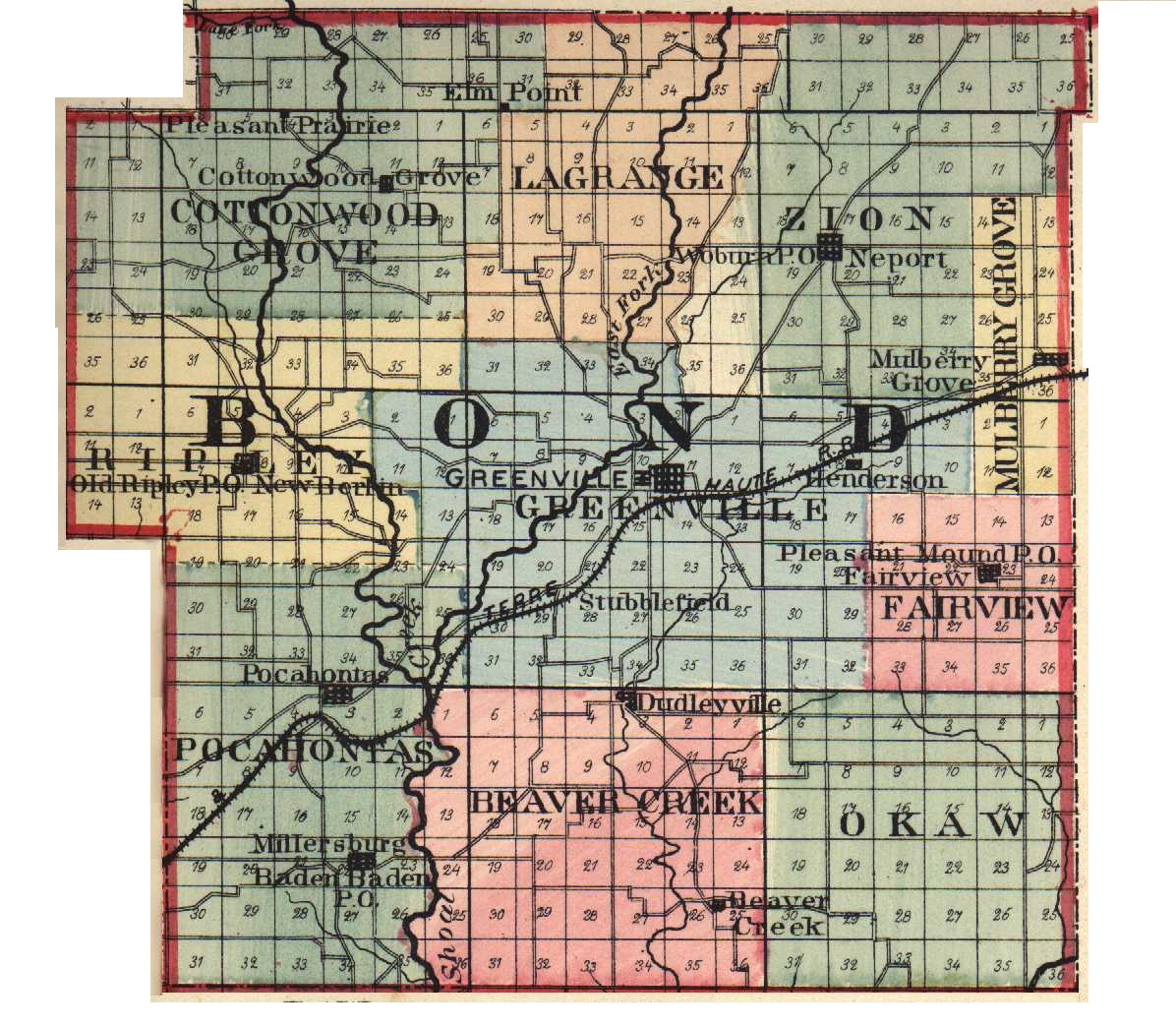
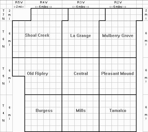
The layout below is a "reasonably accurate" representation of Bond County townships. "Clicking" anywhere on the map will show you who the original land owners were for that section. (The information was extracted from Illinois Public Domain Land Tract Sales Database.)
|
Name |
From |
Description |
Sec |
Twp |
Rng |
Acres |
Date |
Vol |
Pg |
| CRUTHIS, James | Bond | E2SW | 17 | 06N | 04W | 80.00 | 02/11/1837 | 339 | 155 |
| CRUTHIS, John | Bond | E2SE | 17 | 06N | 04W | 80.00 | 03/14/1833 | 343 | 107 |
| CRUTHIS, John | Bond | SENE | 17 | 06N | 04W | 40.00 | 04/23/1833 | 343 | 111 |
| CRUTHIS, Neely | Bond | NENE | 17 | 06N | 04W | 40.00 | 10/14/1854 | 340 | 160 |
| CURTHIS, James | Unknown | W2NE | 17 | 06N | 04W | 80.00 | 02/10/1836 | 324 | 170 |
| DOVE, John | Unknown | NWSW | 17 | 06N | 04W | 40.00 | 03/06/1852 | 351 | 173 |
| MAY, Robert W | Bond | E2NW | 17 | 06N | 04W | 80.00 | 09/21/1854 | 340 | 137 |
| MORGRIDGE, William | Missouri | SWNW | 17 | 06N | 04W | 40.00 | 10/24/1838 | 340 | 13 |
| TISDALE, Ichabod | Bond | W2SE | 17 | 06N | 04W | 80.00 | 08/29/1836 | 339 | 102 |
| VOLLENTINE, William P | Bond | NWNW | 17 | 06N | 04W | 40.00 | 11/14/1836 | 339 | 123 |
| VOLLINTINE, William | Unknown | SWSW | 17 | 06N | 04W | 40.00 | 02/09/1836 | 324 | 169 |